

Author: Tina Eckerlin
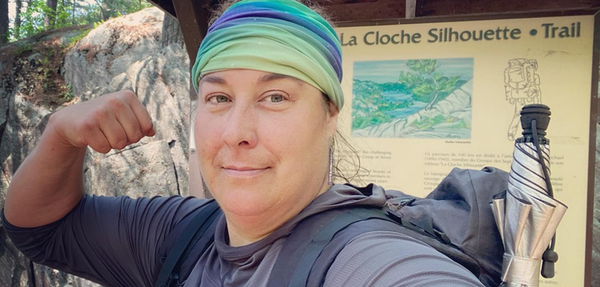
La Cloche Silhouette in a stunning backcountry hiking trail located in Killarney Provincial Park. It is one of over 300 Provincial parks in Ontario.
The park is located in Killarney, near the northern shores of Lake Huron's Georgian Bay. It is about an hour southwest of the Greater Sudbury area, and is one of eight wilderness Ontario Parks.
I had been dreaming of the pink granite near the shores of Georgian Bay, and the white quartzite ridges of La Cloche mountain range.
I tried for two years to reserve backpacking sites on La Cloche Silhouette. When I finally got through the reservation system it was like winning the lottery.
I had planned out every campsite, and calculated my distances. I had multiple trip plans with different sites and distances just in case. Make sure that you have backup plans, because I quickly learned that my first 3 initial itinerary's were not available. I was able to book a few sites I had planned, but had to improvise others.
Also, there is a La Cloche Silhouette Trail Guide book from the Friends of Killarney Park. The guide book in my opinion needs some updating about sites and mileage. However, it was a great resource for planning!

Day 1
I drove through the entrance to Killarney Provincial Park. Today was part of a travel day as the park is located about six and a half hours from my home in Western Quebec. I had spent the previous night part way at a friends home, and made the final leg of my drive today.
I felt like a kid on Christmas morning. I was so excited! It doesn't matter how many trips I do, I always get butterflies from the excitement of an adventure.
I pulled into the Park's Visitor Centre to check-in, retrieved my parking permit and confirm my itinerary. The Park Office was so helpful and friendly!
It was still early in the day, and I knew that I only had a few kilometres from the trailhead to my first site. I decided to explore some of the day hiking trails in the park.

I first hiked Chikanishing Trail. I wanted to dip my toes into Lake Huron's Georgian Bay. I have a goal to dip my toes into all the Great Lakes.
Chikanishing trail was beautiful and only 2.91 km. As I finished the trail, I knew I still had a bit of time so I went for a quick hike to Granite Ridge Trail.
Granite Ridge Trail was 2.83 km, and is where I saw my first small glimpse of white in the distance. It was part of La Cloche mountain range.
I wanted to keep exploring, but I knew that I needed to start my backpacking trip, and that I should probably save my legs for the trail.
I was hiking in a clockwise direction starting at the Baie Fin section. I parked my truck at the end trailhead, and walked the 2 km to the trailhead.
From the trailhead to Lumsden Lake (H2), it was just over 3 km. This stretch of trail was forested, gentle and rolling.
I met a few hikers. One of which was a young man who was just completing the trail. He said he 'couldn't wait to get the hell out of here' through the swarms of mosquitos. I don't think I have ever seen someone hike that fast!
I was wondering if maybe I was in for more than I signed up for?

The trail was easy and rolling. Lumsden Lake site was up on the side of a hill, situated between a pond and the lake. It was a small sloped site, and had a small pad area big enough for a small 2-person tent. It was just right for me.
From the trailhead end where I parked to H2, it was 5.29 km.
I set up camp, made supper and hung my bear bag before tucking in for the night.

Day 2
I didn't sleep well, and was up in the wee hours of the morning. The tent pad was on a bit of a slope so I shimmed my mattress. There had been wolves howling overnight, so amazing!
Unfortunately, there was an excited whippoorwill that let me know repeatedly that they were displeased with my presence.
It was drizzling outside, and the mosquitos were bouncing in a swarm between my tent fly and netting, but I required coffee. So, I quickly grabbed my bear hang and boiled some water in the vestibule of my tent, guzzled some liquid motivation and packed up.
With the rain, rocks were slippery. Right out of the side trail to my camp I crossed a wooden bridge that was partially submerged in the water between two walls of quartzite. It was raining, so dry feet were an illusion. Soakers 5 minutes out of camp.
As approached Artist Creek. I was looking around for the best place to cross when I placed my feet on the smooth algae and pine covered rocks. I spun around and went ass first into the water. The water was not too deep, but I was glad that I had already undone my sternum and hip belt strap for safety.
With a slightly bruised ego and soaked from the chest down, I crossed down stream where the water was knee high. There are always risks when you backpack. Especially, when you are solo and don’t pay attention to where you are stepping.

I started to climb the what is affectionally called The Pig. It is a portage trail that shares the hiking trail. It is a steady climb that doesn't seem to end, but was not as bad as what I had heard from other hikers. I passed the the turn off for the coveted campsite, Topaz Lake and kept trudging on, eating hundreds of mosquitoes while I lugged myself forward.
Coming down the backside of The Pig, I was grateful to no be carrying a canoe. My pack was light, but I had the heaviest food carry I had ever carried, with nine days of food. Distracted in my thoughts I missed the small blue trail marker, and I continued down the portage trail towards Three Narrows Lake.
I came to the bottom and turned left. There were no trail markers, but I could see a trail and followed it until there was nothing left but deer trails along the shoreline.
I knew I missed the trail, but I also knew by my GPS and map that if I kept straight for a bit the trail would cross in front of me.
Shortly, I came right out on to the trail and continued. Normally, I would not have kept on the detour in the backcountry. But, I knew with the lake on my right and the trail somewhere up on my left I only had about fifteen minutes until the trail met up on my bearing again. Meanwhile, I was recording my route in my GPS just in case!
I came upon an old junction with a trail used to cross over a dam that was built in 1934. It has been destroyed and crossing here is now prohibited. My campsite was just on the other side of Kirk's Creek. Instead, I took the 2 km detour along the creek towards a metal bridge. Then the 2 km up to my campsite, Kirk's Creek (H8), the whole time wondering if it would have been safe enough to cross the dam?
Lumsden Lake to Kirk's Creek was 12.5 km. It rained on and off all day, and the mosquitos had been a brutal constant buzzing swarm.
The site was large, sloped and exposed. The sound of the creek and a barred owl in the distance lulled me to sleep.

Day 3
The day started off grey and drizzling as I packed up to make my way towards site H21 on the Three Narrows.
The day was full of stunning hardwoods and mucky areas. I was cruising along when I suddenly hit the ground in agony.
When placing my right foot down, the tree root area had a hole that was covered by moss and pine needles. I must have lied there for 10 minutes shouting out strings of profanities that I am sure were heard miles away.
It wasn't broken as far as I could tell. It seemed to be badly strained or possibly sprained. Crap.
I took some time to rest it, and wrapped my ankle with the 3M self-adhesive tape I always carry. It was about 6 km to my next site. I pressed on and would need to decide what to do when I got there.
The pain was manageable while hiking. I came to the side-trail junction for H21. It was mostly smooth exposed rock downhill for half a kilometre until I reached my site.
The site was a long point dusted with pine needles. The large, smooth exposed rocks jutting out into the water were beautiful. The sun was shining and there was a fabulous breeze. I was finally mosquito free!
I hobbled around setting up camp, angry at myself that I had not been more careful. My ankle was pounding. I ate supper, while soaking my foot along the cold water of the shores.
I elevated my ankle in my tent, took some ibprophen and a shot of the small bottle of Southern Comfort (carried in a mini disposable water bottle) I had brought, for medicinal purposes of course! I started calculating how long it would take me to hike back to the trailhead.
I don't have a satelite communication device, and there was no cell signal to call for help. I even listened for boats to potentially catch a ride and lessen the travel distance. This was my final bail out point. Tomorrow I would hit Moose Pass and it would take days to reach the end of the trail.
At this moment, I felt defeated, almost in tears from the pain and the thought of not being able to see La Cloche Mountains I had been dreaming of for years.

Day 4
I awoke in the night to being bitten by no-see-ums in my tent. I placed my tube banana across my eyes so they wouldn't get bites and swell shut. I looked for a hole in my netting, but could not find it.
I awoke at sunrise with the sound of mosquitos bouncing off the tent. I tested the movement of my ankle. It hurt.
I wrapped my ankle again, and took my time packing up camp...still undecided if I could continue my adventure. I wanted to enjoy every minute I had left.
The thought of hiking up my side trail the 500 metres to the trail junction was intimidating. Walking around camp was painful.
I started my hike. Once I reached the junction I realized that except for a bit of discomfort, my ankle felt great while hiking. I decided to continue, hoping that it was the right choice.
After some gradual climbing I came to a clearing and an open exposed ridge of white. I was finally seeing La Cloche ridges! I could see the point where I had just camped on the Three Narrows. My heart filled.
The trail started to descend steeply. It was all hands and feet on deck! The terrain was dry, so at least I had that going for me. This insanely steep incline followed its way down to a creek. I felt like a mountain goat.

I could heard the sound of water again. I soon came upon a beautiful waterfall. Sure enough the blue trail markers showed that the trail wove its way up the waterfall!
I carefully chose my route, and climbed. I took a small break near the top and filtered some fresh cold water.
Climbing up and down I finally came to the rocky bed of Moose Creek. The trail went straight up. The climb was long and steady, but manageable and shaded with the large grove of hemlock trees.

Finally I made it to the top of a quartzite ridge then down and up again 1.5 km to another summit where I caught my first glimpse of Sliver Peak. I was able to see all of Kirk's Creek Valley where I had come from.
I noticed that I had a phone signal. So, I sent a text home to let my family know that I had twisted my ankle, but felt well enough to continue. I sent my current location and the days intended destination in-case.
The scrambling up and downs had changing scenery, and huge ancient yellow birch trees. I finally came upon the side trail junction for my campsite. Shigaug Lake site H32, one of two sites on the lake. H32 is about 800 metres from the junction.
I worked hard for the mere 11.89 km today. But had been rewarded with the first views I had been dreaming of.

The site was sloped and rocky and I never did find a thunderbox. But the rocky shore rewarded me with a stunning view.
My swim was cold and amazing. It was refreshing to wash away the days grime, cool my itchy bug bites and ease the light swelling of my ankle. I sat at the shore alone on the lake and ate my supper, reflecting on the gift it was to be here.

Day 5
I woke up with visions of the views I had seen the day before. I had been dreaming of misty quartzite mountains and hobbits.
I took my time savouring every sip of coffee near the shore, and then packed up excited for the day. I knew today would be impressive, and planned to take my time to soak it all in.
The morning was filled with some challenging pitches, followed by a smooth winding slope down towards a portage area for Little Mountain Lake and Kirk's Creek. As recommended by the Guide Book, I filtered water and drank my fill to prepare for the water scarcity of the coming ridge walks.

The maps contour lines of this area look intimidating, but there are long stretches of ridge-walks with cairns marking the way. It was a very hot day, and I used my umbrella to create shade along the exposed ridges. The day continued with ups, downs and impressive ridge-walking. Some areas were flat ridges, others meandering paths through grassy and rock outcrops.
I was able to send another text to my family to confirm my location and destination. They had my itinerary, but it is always best to check in if possible with your last known location.
Along a ridge, the side-trail junction sign for David Lake and Boundary Lake suddenly appeared. I turned right and headed down towards Boundary Lake.
I could feel the temperature difference as I walked downhill through the hardwood forest.

I crossed a dry stream bed, which must be rushing in the spring with the mountain's melting runoff. I came to a large and secluded coniferous site 700 metres from the junction. There were smooth rocky outcrops at the shore.
Today was a very hot and humid 9.16 km, with some good climbs and a few scrambles. I was glad that I had take my time with the extreme heat. I set up camp, and rinsed away the days grime.
I finally found the hole in my tent near the seam of my zipper that was allowing the no-see-ums to get in. I patched it, and then made myself comfortable at the shore to watch the sunset, so perfectly content.
I fell asleep imagining what tomorrows hike to Silver Peak would be like.

Day 6
I watched the sunrise over the lake while enjoying a coffee. I quickly packed up camp and started my ascent back to the main trail. I stopped for a trail breakfast, and picked some blueberries to add to my peanut butter and granola bar.
I took the time to knock over some rogue cairns on the trail that people had built. At one point a grouping of Inuksuk's started leading me astray. Word of advice, cairns are created for navigational purposes. When people build these for art they are a type of graffiti, and can lead hikers off their course. Please refrain from building these. Don't be a dick on the trail! It could get someone lost.

Some of the views here were outstanding with the morning sun!
Once again I was descending, and crossed over a marshy area and then walked around a large beaver pond. I topped off my water, and I finally reached the junction for Silver Peak.
I had considered hanging my pack and only carry my fanny pack. However, I could not find a suitable tree to hang my gear. I also had the forethought that if something happened along the way, I could set up an emergency camp. I had a day-hiking experience a couple of years ago where I was not prepared. So taking the pack it was.
I started the slow and lung-busting 2.5 km ascent to Silver Peak. There were some amazing glacial boulders along the trail with moss and ferns growing on top like a Chia Pet.
It was just before 11 am when I made the first summit to the highest point in the park. It took my breath away. The panoramic 360 degree view was spectacular on this clear day. In one direction I could see the smoke stacks in Sudbury, in the other direction I could see Georgian Bay and Manitoulin Island.

I could trace most of my hike so far from George Lake Campground towards the Three Narrows, continuing along La Cloche ridges.
I shared the mountain top with a mom and her daughter taking a day hike while on their canoe trip.
I enjoyed lunch and solitude in the sun, and lounged soaking it all in. I hiked to the other summit at the old fire tower. The sound of the wind pulled my mind further away. This was one of the highlights of my trip. I started to loose track of time, but was pulled out of my day dreaming by a gaggle of day hikers. It was starting to get crowded. Time to make my descent.
After the Silver Peak trail junction, the trail leading towards Bell Lake and Silver Lake is wide and well-used by day hikers. La Cloche Silhouette trail branches off to the right towards Silver Lake. I encountered some large boulders forming parallel walls again not far from my campsite at Silver Lake, H38.
The campsite sits upon a quartzite hill. Across the lake was an impressive wall of white quartzite. My hike today was 11.63 km, including the side trip to Silver Peak.
The Guide Book describes this site as having steep water access. There was a small trail with a rope down towards the water on one side. The water level had receded here, and was a mucky mess. No access to the water at all. The other side was similar with thick brush and muck.

The area in front dropped down off of the quartzite. It may have been possible to drop down, but I could not figure out how I would get back up.
I made my way to the campsite next to me to see if I could fill up my water. A lovely couple let me fill up my bottles, and prefiltered a large bladder bag to lend me for the night. They were about to go for a swim. I was jealous, it sounded wonderful. But, I did not want to disturb them anymore.
I will also note that the Guide Book states that site H37 and H38 share a privy. They have since installed a thunder box for each site since its publication.
I set up camp, grateful for the hydration and the days adventures. I drifted to sleep hearing the wind from Silver Peak in my mind.

Day 7
The morning air was hot and heavy. It was going to be a scorcher again today.
I packed my gear, and doubled back up the trail to leave the borrowed water bladder on the side trail as promised.
The scenery today changed from rolling hills to exposed quartzite climbs, and menacing rockface scrambles. There were some bluffs with spectacular scenery. The view of Heaven Lake was stunning.
I stopped at site H47 right on the trail for lunch. It is a small lake nestled among the white stony outcrops, I would try to stay at this site on another trip.
I came towards a portage area with small sections of bridging, and then another eroded and exposed climb before another ridge. From here it was a hop, skip and a jump to my campsite at Little Lake Superior, H49.

The campsite was huge and breezy! One of the water access areas is a white stone outcrop that drops down to a flat 3-4 foot wide shelf. The shelf had about 6 inches of water before it dropped deeply into the lake. I jumped into the cold water and sat on the shelf like it was a kiddy pool for a long time. There is something so freeing about having a whole remote lake to yourself! I had enjoyed solitude at almost every site. I finished off my remaining drams Southern Comfort, and then air dried in the wind.
I would be hiking through The Crack in the morning. It sounded ominous. I fell asleep to strong winds and the patter of rain drops on my tent.

Day 8
I woke up at 4 am. Ugh... The good news is that I got to start hiking earlier!
I started uphill right out of camp. The nights rain had left things slick, and it was a tricky scramble and I made sure my footing was solid in each step. From here I could see Little Lake Superior. As I do at every campsite, I thanked her for such a fabulous and safe stay.
As I made my way towards The Crack, the sun help dry off the remaining moisture from the rain. Some of the cliff faces allowed for amazing views. Lord of the Rings anyone!

I slowly made my descent through The Crack, making sure my footing was stable as I made my way down. To say that this natural passage is impressive is an understatement! I imagined how many people have walked through this passage before me since before time is remembered.
Once out in the open from The Crack, heading down I lost sight of the trail markers and cairns. Eventually, I found the trail again.

The trial from here is easy going for the most part. Suddenly, you are on pink granite rock then back into the rolling forest.
I had reserved site H53 for tonight. It had been hard to determine how long it would take me to hike my last day, as I knew I would be navigating The Crack. But, with an early start I was making great time. I decided to hike out and drive home since it was only around lunchtime.
As I made my way towards the end of the trail, I tried to organize the overwhelming scenic images swirling around in my mind from the last 8 days, I finally understood why the Group of Seven had been so entranced by Killarney. It is ruggedly beautiful and is truly the GEM of Ontario. It is so unique in its everchanging landscape.
I made it to the parking lot and took a quick dip in the lake and changed out of my hiking clothes. Today's hike was 13.5 km.
I went to start my truck, and the battery was dead. (Tip: always back into your spot for easier towing or boosting!)
A local camper had her park information handy and called the park office for me. I connected my cables and within 15 minutes a fabulous and friendly Park Warden came and gave me a boost.
My experience at Killarney Provincial Park was amazing. It was a tough hike totaling just over 90 km. I had planned 8 nights and 9 days, with the first and last night being low millage days for travel to and from the park.
I completed it in 7 nights, but feel that this could be done in 4-6 nights comfortably. I would likely choose 5 nights for reasonable distances and time to enjoy the trail, but each person needs to hike at their own pace. The distances between you and the park, between your sites and the weather will have a huge part to play in this.
Needless to say, despite the heat and injury, I can't wait to go back!
Check out our video trip report of La Cloche Silhouette Trail on our YouTube Channel. There were lots of issues with the audio, but you can see the beauty of the trail!
La Cloche Silhouette Trail - Part 1
La Cloche Silhouette Trail - Part 2

Have you ever hiked La Cloche Silhouette Trail? What were your impressions?
Share your thoughts in the comments below!